|
Our project has 5 main objectives:
1. Conduct an analysis of the natural (historic) range of variability (NRV) of YPMC forests. 2. Analyze current conditions of YPMC forests in four southern California NFs to determine how forests have deviated from historical conditions. 3. Model future suitable habitat for Pinus jeffreyi seedlings and saplings in San Bernardino National Forest under various climate change scenarios. 4. Identify priority conservation areas within YPMC forests in SBNF based on (1) results from objectives 1-3 and (2) vulnerability to future threats such as drought and climate change. 5. Establish a case study in SBNF exploring how the USFS can apply the results to the above objectives into a management plan that promotes forest resilience under a changing climate. |

Photo: Nathan Wickstrum
|
Currently, there is no compiled source of the natural range of variation (NRV) for southern California National forests. A NRV would include: analysis of forest structure (tree density, size and class distribution), functional analysis (fire, logging, grazing), and composition (distribution of forest types). These components are important for forest maintenance and restoration of ecological conditions. The current approach of forest managers across the state is to thin forests close to historic conditions in order to reduce the likelihood of severe wildfires and prevent drought induced mortality. However, due to an uncertain future climate, restoring forests to historical conditions may be infeasible. This project will assess the natural range of variation in addition to analyzing current research to provide the client with feasible management objectives that maximize forest resilience under a changing climate. This will aid the U.S. Forest Service (USFS) to better direct their limited funds to more effectively manage and conserve YPMC forests for future generations.
Past
Some question the relevance of referring to historical conditions to inform present and future management goals when climate change might result in novel ecosystems. However, NRVs are more than a simple snapshot of the past. Historical conditions provide invaluable insight into how ecosystems and species may respond to differing intensities and frequencies of disturbance events. Understanding these reactions allows managers to set goals for a dynamic, resilient system that will promote long-term sustainability of the forests. NRVs have been used to define which ecological conditions make ecosystems most resilient, to evaluate feasibility of management goals, and to design sustainable management plans that incorporate using the land as an economic commodity.
There are over a dozen topics that can be included in the NRV, however we will not have time to analyze all topics. Consultation with USFS personnel from the southern California National Forests revealed the 6 most important topics that we will assess:
There are over a dozen topics that can be included in the NRV, however we will not have time to analyze all topics. Consultation with USFS personnel from the southern California National Forests revealed the 6 most important topics that we will assess:
|
1. tree density
2. tree size and size class distributions 3. tree basal area/volume (forest biomass) 4. canopy cover 5. forest gaps and tree clumps 6. Understory shrubs. Wieslander historical plot data and historical literature will be used to determine a range of means for each indicator variable. Characterizing historical data based on a range of means produces a more meaningful method of comparison against current data, as opposed to comparing current data to entire historical ranges of variation that capture unrepresentative environmental extremes. |
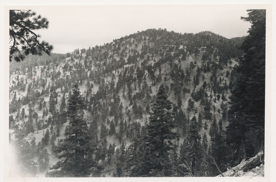
Photo: Albert Everett Wieslander
|
Present
The southern California NFs fall within the Central Coast, South Coast, and South Interior CALVEG regions. We used the Jeffrey Pine, Eastside Pine, Ponderosa Pine-White Fir, Ponderosa Pine, Douglas Fir-Ponderosa Pine alliances to identify yellow pine forests. Mixed Conifer-fir and Mixed Conifer-Pine alliances were used to identify mixed conifer forests.
We plan to analyze current forest structure and composition in all four southern California NFs (excluding the northern unit of LPNF) using client plot data, enterprise plot data, and FIA data. ArcGIS layers of vegetation plots, fire, and elevation data will be obtained and clipped to our study region. We will explore forest structure and composition in each forest individually and divide the forests into assessment areas based on landscape characteristics such as elevation, aspect, tree density, or fire return interval departure (FRID) condition class.
The results of current conditions will then be compared to the range of means determined during the historical analysis to determine how much forest structure and composition has deviated from historical conditions. Quantitative analysis will compare current forest conditions to historical conditions through statistical testing and linear mixed modeling.
Future
Forests face a broad array of threats due to climate change. In California, climate change is expected to increase mean average temperature, increase the frequency of extreme temperature events, and reduce average precipitation. Climate is a strong influence on vegetation distribution; vegetation in California is expected to move towards higher elevations by the end of the century. During severe climatic events, such as droughts, individuals at lower elevations have higher mortality rates than individuals at high elevations. Prolonged droughts increase susceptibility to bark beetle and pathogen mortality. Climate change is also projected to result in more frequent and intense wildfires. After stand replacing fires, there may be fewer opportunities for seedlings to regenerate the lost forest because seedlings are extremely sensitive to environmental conditions, such as near surface temperature. Thus, forests risk being replaced by another vegetation type.
Geographic Scope
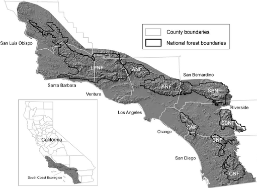
Figure 1. via Teresa J Brennan
|
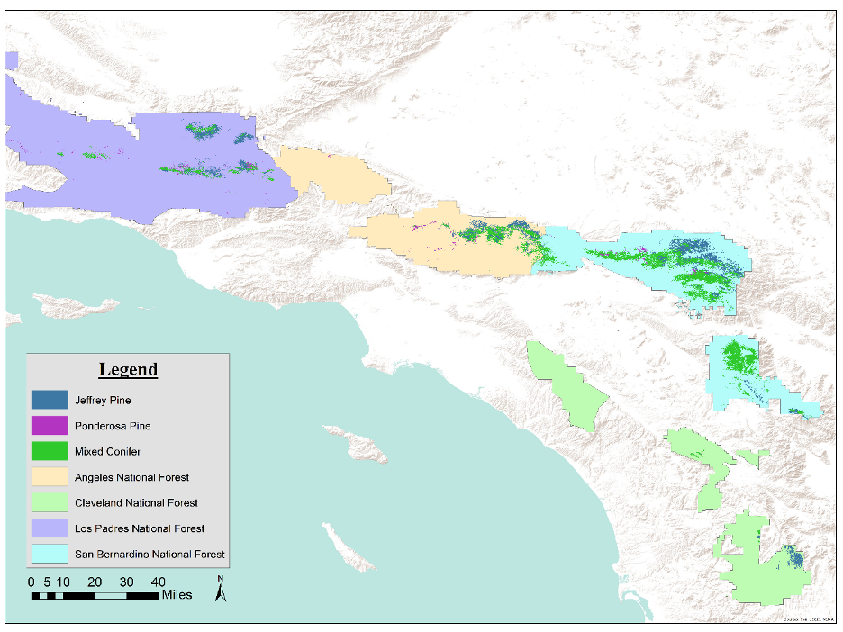
Figure 2. via Anne-Marie Parkinson
|
Our team will be analyzing historic and current YPMC forest structure in all four southern California National Forests along the Transverse and Peninsular Mountain Ranges: Southern Los Padres (LPNF), Angeles (ANF), San Bernardino (SBNF), and Cleveland (CNF)(Figure 1). Figure 2 shows the YPMC habitat in each forest. SBNF has about 179,447 total acres of YPMC forests, which is the highest of all four National Forests. CNF has the lowest total acreage of YPMC forests with just 10,638 acres.
Future species distribution models will be done just for the SBNF because it has the highest acreage of YPMC and because of genotypic variation among forests.
Future species distribution models will be done just for the SBNF because it has the highest acreage of YPMC and because of genotypic variation among forests.
